• Update Date: 12/08/2018
  • Basemap Data Source: MaineDOT ArcGIS REST Services (Link) (Copyright: Maine Department of Transportation (MaineDOT))
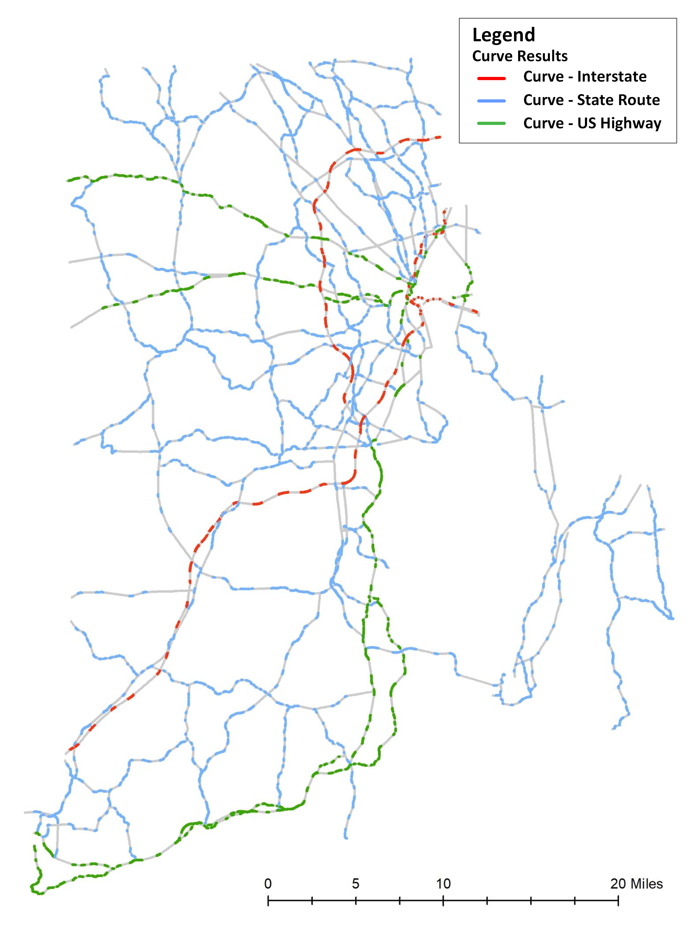
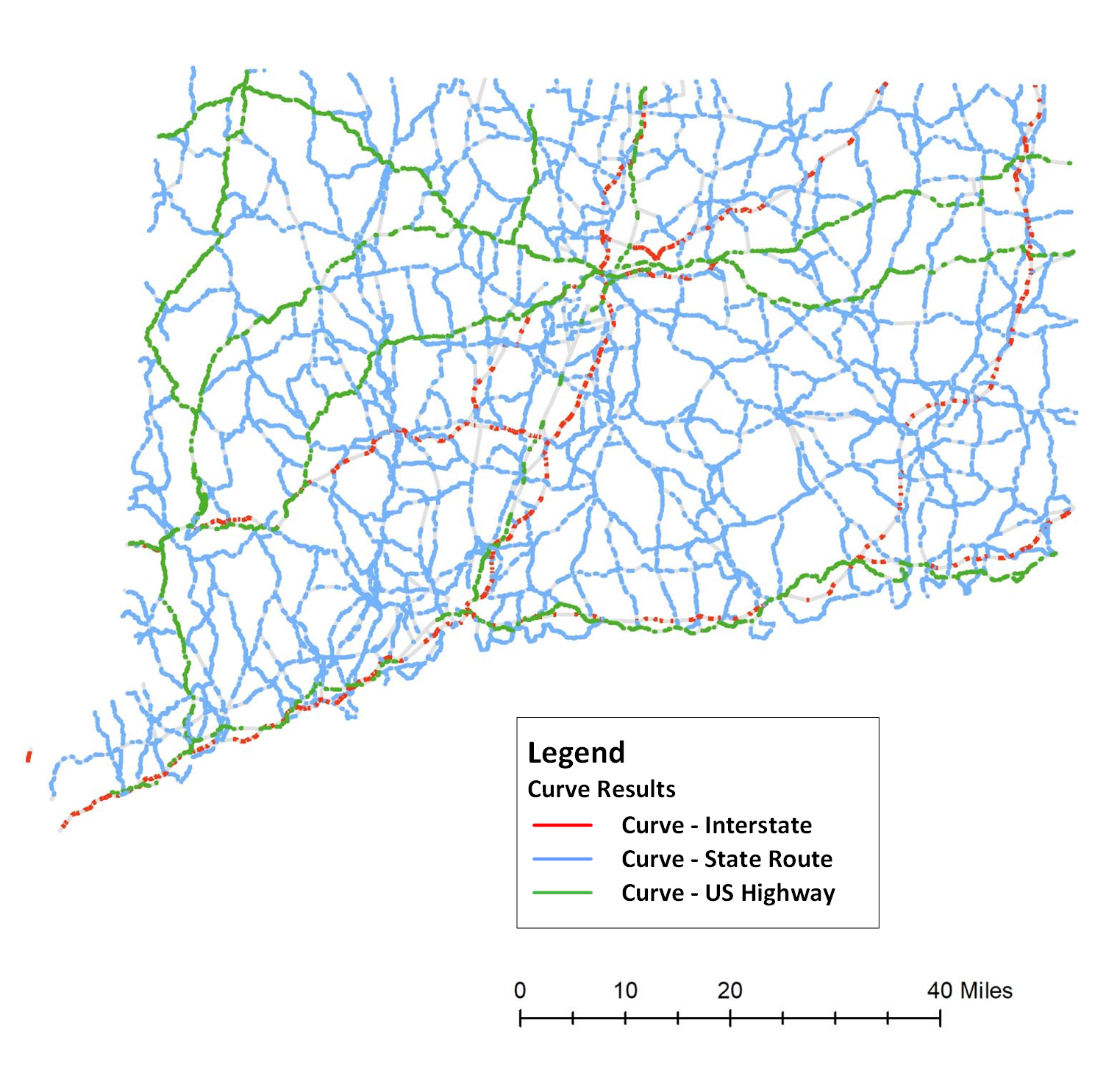
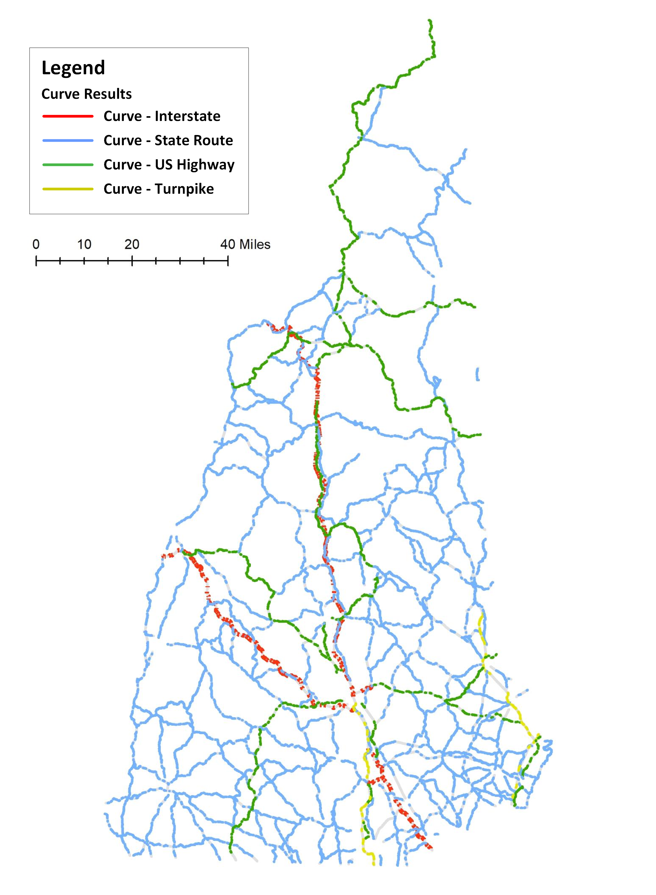
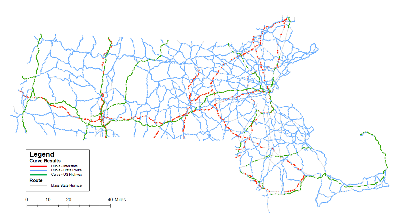
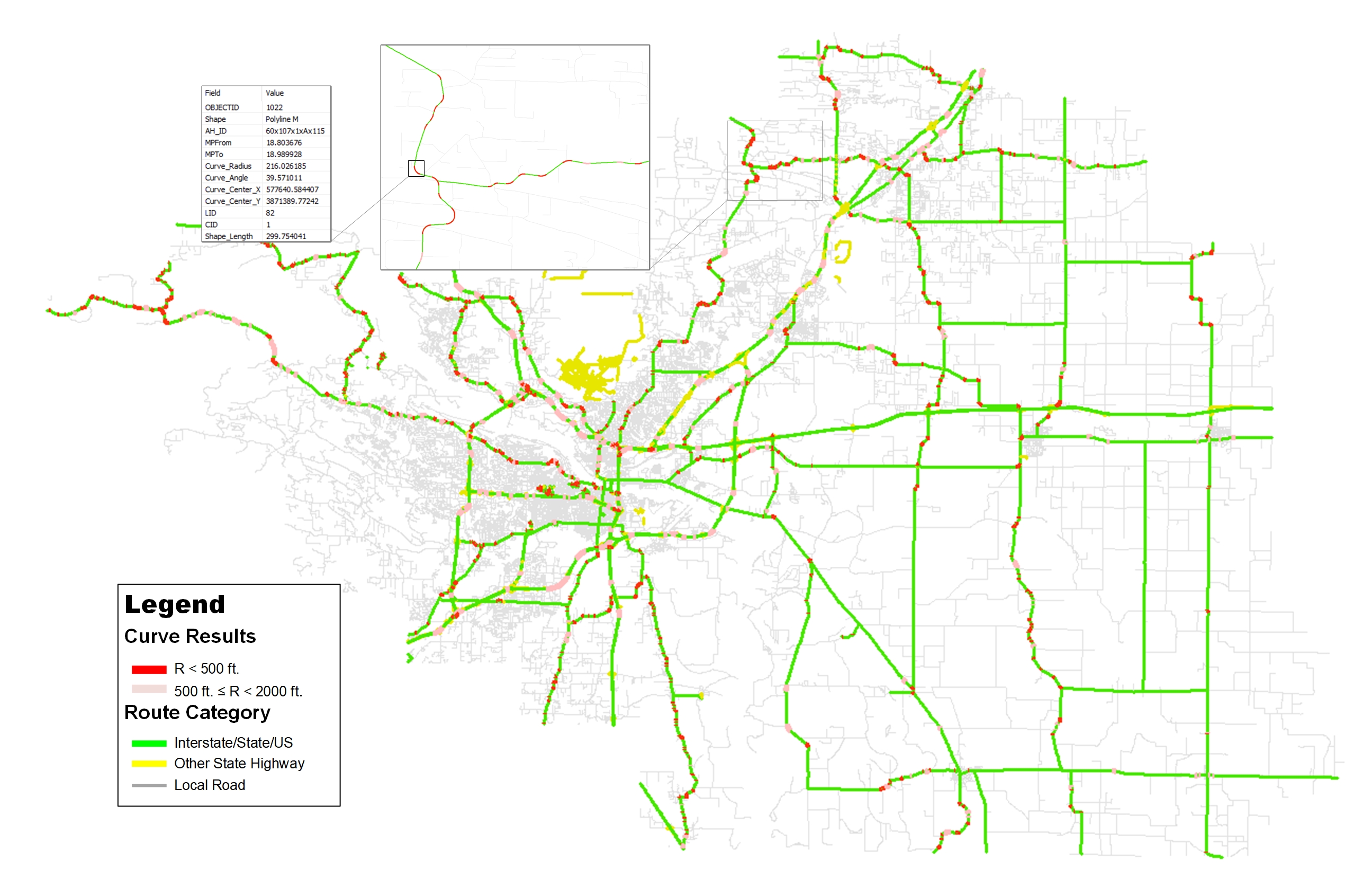
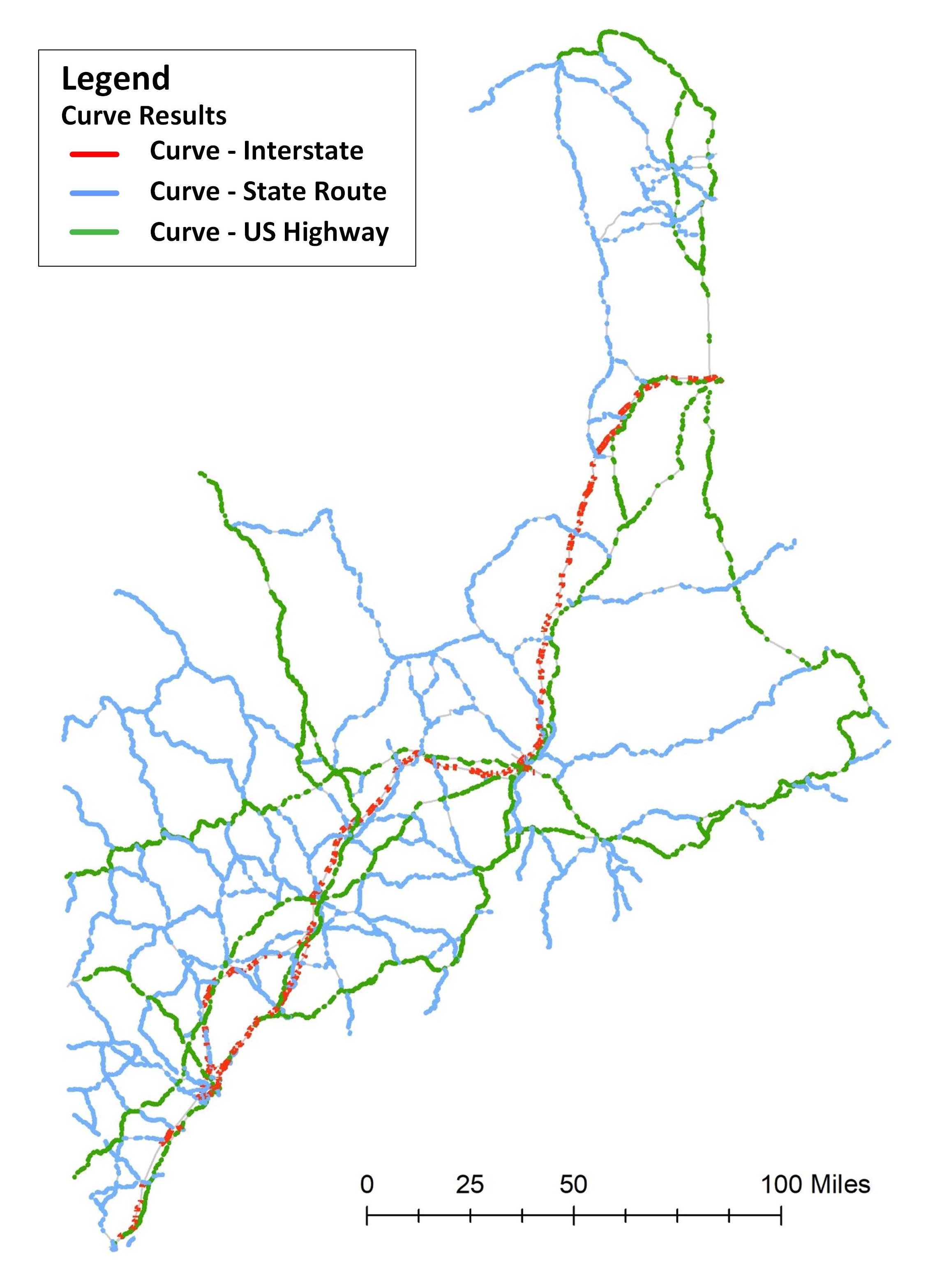
  • Coverage: Maine State Highway System
  • Layers: MaineDOT_Curve (7,518 Events), State_Route_LRS (131 Routes)
  • Format: MDOT_Curve_v02.gdb
  • Dataframe: GCS_North_American_1983 (GCS), NAD_1983_UTM_Zone_19N (Meters) (PCS)
  • Download Link: Please contact Ai Research Group for instructions

Disclaimer – All the results and information for the horizontal curves on this website were derived ONLY for academic research purposes. The Ai Research Group derived the results based on the publicly available data at the time of processing, but it does not guarantee any changes in the data sharing policy of the hosting agencies. Please contact the data hosting agencies for more information. The copyright of the data belongs to the data hosting source as the copyright text indicates. The Ai Research Group has internally evaluated and validated the results before it releases any results on this website, but it does not guarantee the quality and the accuracy of the results, nor imply any of its potential applications. Please use the data and the results at your risk, and please use the data ONLY for academic purposes.

  • Update Date: 11/08/2018
  • Basemap Data Source: Rhode Island Department of Transportation RIDOT Roads (2016) (Link) (Copyright: Rhode Island Department of Transportation (RIDOT))
  • Coverage: Rhode Island State Highway System
  • Layers: RIDOT_Curve (2,048 Events), State_Route_LRS (66 Routes)
  • Format: RIDOT_Curve_v02.gdb
  • Dataframe: GCS_North_American_1983 (GCS), NAD_1983_StatePlane_Rhode_Island_FIPS_3800 (Meters) (PCS)
  • Download Link: Please contact Ai Research Group for instructions

Disclaimer – All the results and information for the horizontal curves on this website were derived ONLY for academic research purposes. The Ai Research Group derived the results based on the publicly available data at the time of processing, but it does not guarantee any changes in the data sharing policy of the hosting agencies. Please contact the data hosting agencies for more information. The copyright of the data belongs to the data hosting source as the copyright text indicates. The Ai Research Group has internally evaluated and validated the results before it releases any results on this website, but it does not guarantee the quality and the accuracy of the results, nor imply any of its potential applications. Please use the data and the results at your risk, and please use the data ONLY for academic purposes.

  • Update Date: 10/08/2018
  • Basemap Data Source: Connecticut Department of Transportation Web-GIS (Link) (Copyright: Connecticut Department of Transportation (CTDOT))
  • Coverage: Connecticut State Highway System
  • Layers: CTDOT_Curve (11,983 Events), State_Route_LRS (408 Routes)
  • Format: CTDOT_Curve_v03.gdb
  • Dataframe: GCS_WGS_1984 (GCS), WGS_84_Pseudo_Mercator (WGS_1984_Web_Mercator_Auxiliary_Sphere) (PCS)
  • Download Link: Please contact Ai Research Group for instructions

Disclaimer – All the results and information for the horizontal curves on this website were derived ONLY for academic research purposes. The Ai Research Group derived the results based on the publicly available data at the time of processing, but it does not guarantee any changes in the data sharing policy of the hosting agencies. Please contact the data hosting agencies for more information. The copyright of the data belongs to the data hosting source as the copyright text indicates. The Ai Research Group has internally evaluated and validated the results before it releases any results on this website, but it does not guarantee the quality and the accuracy of the results, nor imply any of its potential applications. Please use the data and the results at your risk, and please use the data ONLY for academic purposes.

  • Update Date: 09/08/2018
  • Basemap Data Source: New Hampshire Clearinghouse Portal (Link) (Copyright: New Hampshire Department of Transportation (NHDOT))
  • Coverage: New Hampshire State Highway System
  • Layers: NHDOT_Curve (10,639 Events), State_Route_LRS (125 Routes)
  • Format: NHDOT_Curve_v05.gdb
  • Dataframe: GCS_North_American_1983 (GCS), NAD_1983_StatePlane_New_Hampshire_FIPS_2800 (Meters) (PCS)
  • Download Link: Please contact Ai Research Group for instructions

Disclaimer – All the results and information for the horizontal curves on this website were derived ONLY for academic research purposes. The Ai Research Group derived the results based on the publicly available data at the time of processing, but it does not guarantee any changes in the data sharing policy of the hosting agencies. Please contact the data hosting agencies for more information. The copyright of the data belongs to the data hosting source as the copyright text indicates. The Ai Research Group has internally evaluated and validated the results before it releases any results on this website, but it does not guarantee the quality and the accuracy of the results, nor imply any of its potential applications. Please use the data and the results at your risk, and please use the data ONLY for academic purposes.

  • Update Date: 07/21/2018
  • Basemap Data Source: MassDOT ArcGIS REST Services (Link) (Copyright: Massachusetts Department of Transportation (MassDOT))
  • Coverage: Massachusetts State Highway System
  • Layers: MassDOT_Curve (13,422 Events), State_Route_LRS (171 Routes)
  • Format: MassDOT_Curve_v09.gdb
  • Dataframe: GCS_North_American_1983 (GCS), NAD_1983_StatePlane_Massachusetts_Mainland_FIPS_2001 (Meters) (PCS)
  • Download Link: Please contact Ai Research Group for instructions

Disclaimer – All the results and information for the horizontal curves on this website were derived ONLY for academic research purposes. The Ai Research Group derived the results based on the publicly available data at the time of processing, but it does not guarantee any changes in the data sharing policy of the hosting agencies. Please contact the data hosting agencies for more information. The copyright of the data belongs to the data hosting source as the copyright text indicates. The Ai Research Group has internally evaluated and validated the results before it releases any results on this website, but it does not guarantee the quality and the accuracy of the results, nor imply any of its potential applications. Please use the data and the results at your risk, and please use the data ONLY for academic purposes.

I recently had some time to explore the feasibility of network-level horizontal curve extraction using my previous iterative circular fitting algorithm. Working on GIS base maps is definitely more challenging than on the GPS trajectories, because of three primary reasons: 1) the density of the point sequence changes dramatically between a tangent section and a curved section, which needs a new mechanism to dynamically adjust the maximum iterations in the algorithm; 2) the intersecting sections of the road create confusion in the point sequences, which needs a better segmentation of the network before applying the algorithm; 3) divided highways occasionally have different curvatures, which need a better result-merging and book-keeping mechanism to minimize duplication in the results. The original algorithm can be found here in this paper (link), but I had to update the algorithm with additional steps to address the three challenges mentioned above. Here is a sample result for Lonoke County, Arkansas, using the improved algorithm. Obviously, Dr. Xu from the University of Nevada at Reno (link) and Dr. Li from the University of Louisville (link) have made a few steps ahead in applying their algorithms in a few GIS base maps. I hope soon I will be able to make a benchmarking among these state-of-art curve finding algorithms. In the meanwhile, I will try to collect different open base maps from state departments of transportation and share the network-level horizontal curve results using my improved algorithm. Hopefully, I will be able to accumulate enough results to create a national horizontal curve for most of the state highway systems. Of course, in a longer run, including local roads will create a whole new bunch of challenges, but that will be the next ambitious plan after the state highway systems.